Our Company

Trusted infrastructure consulting expertise built on nearly four decades of nondestructive evaluation leadership. Our client-focused approach delivers trusted results.

Services

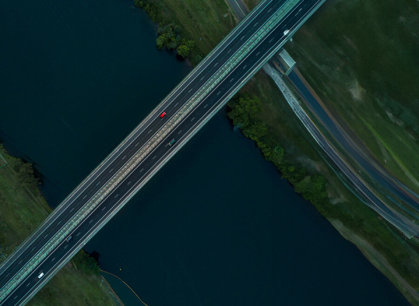
Comprehensive infrastructure assessments that minimize disruption while maximizing data quality. Our experienced teams deliver actionable reports and strategic recommendations that protect your assets.
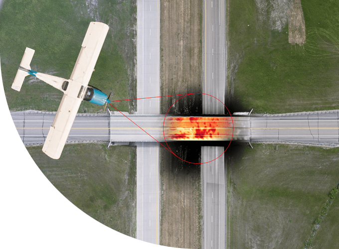
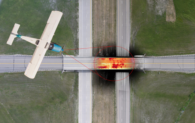
Technology

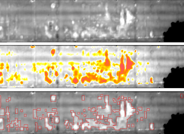
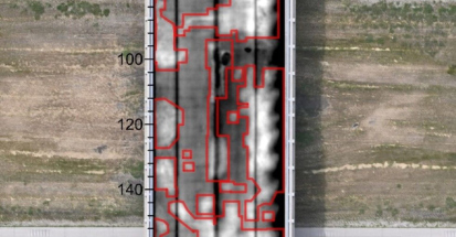
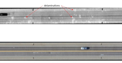
Advanced NDE technologies that reveal critical infrastructure conditions without costly shutdowns. Our proven methods deliver the precise data you need for confident maintenance decisions.

Aerial Imaging

Aerial Comprehensive Infrastructure Assessment

Overview

Infrasense utilizes advanced aerial platforms including fixed-wing aircraft equipped with Infrared Thermography (IR) and high-resolution visual imaging systems to assess infrastructure conditions. Since 2019, Infrasense has analyzed thousands of bridge decks across six states: Wisconsin, Rhode Island, Indiana, Texas, Alaska, and North Dakota.

Aerial IR offers significant advantages over traditional chain-dragging: safer data collection with no traffic disruption, efficient coverage of multiple structures per day, and access to difficult-to-reach areas. Unlike subjective chain-drag methods prone to inconsistency, Aerial-IR provides objective, verifiable results with complete underlying data records. What you see is what you get—no guesswork.

Thermal and visual data are analyzed using proprietary algorithms and geo-referenced with high-precision GPS to accurately identify and locate areas of concern across entire project corridors.

Capabilities

Rapid assessment of multiple structures in single mobilization
Efficiently scan hundreds of decks per day
Complete infrastructure coverage without traffic disruption
Improve safety with zero personnel exposure to traffic
Accurate, high-resolution visual documentation of surface conditions
IR results within 4% of chain-drag on average
Reduce costs with inspections at a fraction of traditional methods

Results You Can Trust

In addition to comprehensive aerial assessment, the processed imaging data provides the following:

  • Comprehensive NDE Inspection Reports
    Infrastructure conditions quantified and mapped with thermal analysis and recommendations for repair or restoration.
  • GIS & CADD Compatible Condition Maps
    Plan-view maps showing thermal anomalies, surface defects, and structural conditions by span or section.
  • Geospatially Referenced Results
    Allowing integration into ArcGIS with high-resolution aerial imagery and thermal overlays of entire project areas.

Ready for a Project?

Consult with our experienced team today to discuss your aerial mapping needs for your infrastructure assessment project.

REQUEST A QUOTE
“NCE has partnered with Infrasense on local and state highway pavement evaluation projects for more than 15 years. Infrasense provides extensive knowledge and expertise with GPR testing and analysis, providing valuable layer thickness information for assessing and selecting pavement rehabilitation treatments. Due to Adam and his team, Infrasense is the only GPR specialty firm we call.”
— Linda Pierce, Principal, Nichols Consulting Engineers
“We’ve partnered with Infrasense on a range of projects over the years, and they’ve consistently delivered. Their team brings deep technical expertise, professionalism, and a willingness to go the extra mile—especially on fast-moving or complex jobs where precision matters most. When we need GPR or specialized NDE, Adam is always our first call.”
— Mollie Rhett, Director of Marketing, ICC-IMS
“For a complicated project in Harvard Square, Kleinfelder hired Infrasense to conduct GPR of the roadway, redline tunnel and the utilities using Infrasense’s technology. The data was proven to be valuable to determine the existence of utilities in question where records were not complete, the roadway structure, and the MBTA redline tunnel where we were not able to get a permit to excavate to locate the top of the tunnel due to permitting issues. The data and technology has come a long way and was proven to be invaluable.”
— Tyson Ross, Senior Project Professional, Kleinfelder
“Infrasense is an essential part of our strategy to monitor the condition of our wearing surfaces throughout the state, providing cost-effective and reliable results. This data is essential for our bridge management system which is focused on bridge deck preservation.”
— Philip Meinel, WisDOT Structures Asset Manager

Have a Question?